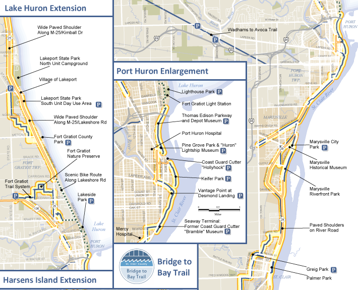
Bridge to Bay Trail Map
The Bridge to Bay Trail is a nearly complete 54 mile paved trail system in St. Clair County. It is a popular recreational trail enjoyed by both residents and tourists for walking, running, biking and rollerblading.
Client
St. Clair County
200 Grand River
Port Huron, MI 48060
Mark A Brochu, Director
810-989-6960
Date: 2008, updated in 2011 and 2013
Our Task
Developed using geographic information systems (GIS), the Bridge to Bay Trail Map illustrates the connecting routes and helps users navigate the trail. The map also includes enlargements of urban areas and highlights numerous points of interest along the routes.
For more information about trails in St. Clair Count, visit the St. Clair County Trail and Routes Action Plan, also completed by the Greenway Collaborative.
Downloads
Bridge to Bay Trail Map (Updated 2013)

