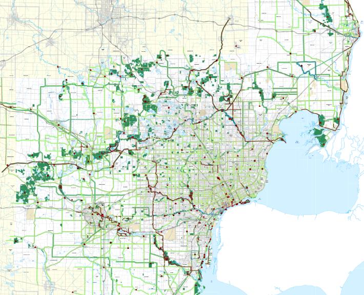
Southeast Michigan Trails and Greenways Vision
This project utilized a series of public workshops for gathering input from a seven-county region in Southeast Michigan to develop a regional trail and greenway vision.
Client
The Greenways Initiative
Community Foundation for Southeast Michigan
333 W Fort Street
Detroit, MI 48226
Tom Woiwode, Director
313-961-6675
Date: 2006 – 2007
Our Task
The Greenway Collaborative assisted and facilitated workshops for each county and developed a geographic information system (GIS) to record public input and create maps.
The results identified existing, planned and conceptual corridors. The greenway vision will help communities identify and prioritize links within their jurisdiction. It will also help foster the connection of bike and hiking trails, conservation corridors and habitats among and between communities in the region.
Vision Maps & Data
Vision Maps
City of Detroit
Livingston County
Macomb County
Monroe County
Oakland County
St. Clair County
Washtenaw County
Wayne County
Regional Vision Map – Small
Regional Vision Map – Large
Vision GIS Files
MapInfo Native Files
MapInfo Export Files
ArcView Shape Files
Google Earth KMZ Files
Grouped by Status
Grouped by Type
Grouped by Class
Workshop Maps
Regional Workshop Maps
City of Detroit
Livingston County
Macomb County
Monroe County
Oakland County
St. Clair County
Washtenaw County
Wayne County
City of Detroit Workshop Maps
Overview
East
Central
West
Livingston County Workshop Maps
Overview
Southeast
Northeast
Northwest
Southwest
Macomb County Workshop Maps
Overview
North
South
Monroe County Workshop Maps
Overview
Northeast
Northwest
South
Oakland County Workshop Maps
Overview
Southeast
Northeast
Northwest
Southwest
St. Clair County Workshop Maps
Overview
North
South
Washtenaw County Workshop Maps
Overview
Ann Arbor/Ypsilanti
Additional Resouces

