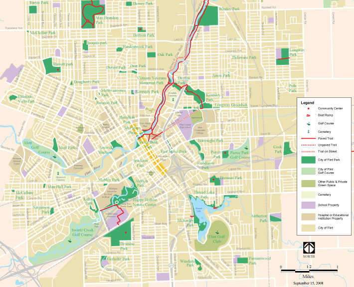
City of Flint Parks Map
The City of Flint contains more than 1,800 acres of public green space. Surprisingly, there has never been a map displaying this complex system of parks until now.
Client
U of M Flint – CAER
432 N. Saginaw St., Suite 1001
Flint, MI 48502
Leyla Sanker, Project Coordinator
810-767-7183
Date: 2008
Our Task
The Greenway Collaborative created a map that locates all of the public parks within the City of Flint. The map highlights parks and recreations space along with describing the type of facilities associated with each park. Detailed inset maps of some of the more popular parks were also included on the backside of the map.
Downloads

