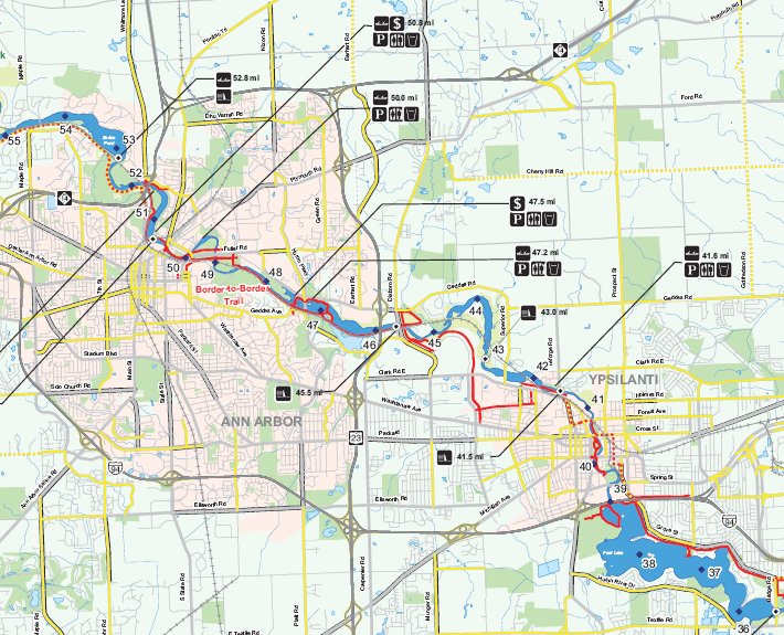
Huron River Water Trail Map
The Huron River Water Trail travels through southeast Michigan along the Huron River, passing through several local, regional and state parks.
Client
Huron River Watershed Council
1100 N Main St
Ann Arbor, MI 48104
Laura Rubin, Executive Director
Date: 2009 – 2012
Our Task
As a pro bono project, the Greenway Collaborative worked with a diverse group of partners lead by the Huron River Watershed Council to develop a set of GIS based planning tools as a resource for the Huron River Water Trail planners and users.
The Greenway Collaborative also assisted with developing the Huron River Water Trail Website.
Downloads
Huron River Water Trail Map
High Resolution
Low Resolution

